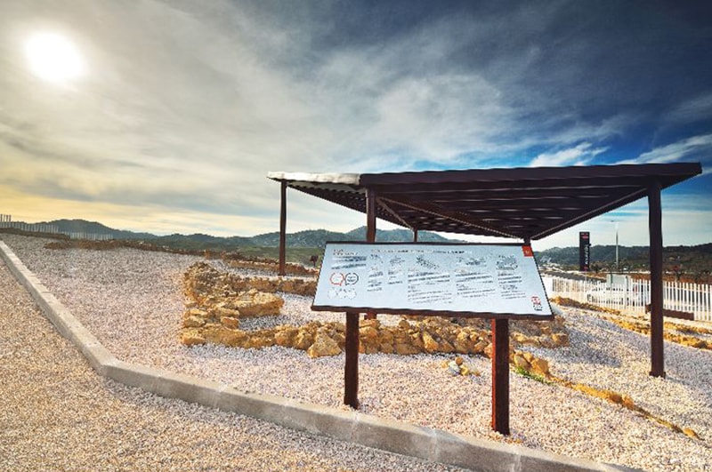
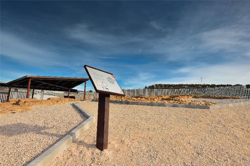
Two steel canopies cut out against the mountains, two colours of gravel and a red aggregate path: that is all you see, and that was the idea. Archaeological monitoring of a motorway scheme turned up a Roman villa on the very hill the new alignment was due to cross. Andalusia’s regional culture department would not allow it to be destroyed, so the remains were lifted, moved 2,340 metres south and rebuilt on an artificial mound shaped to the topography of the original hill. Our commission was the final phase, the one that decides whether any of that effort is ever seen: an outdoor museum design for an archaeological site in Antequera (Málaga).
The commission: the villa had already moved before we arrived
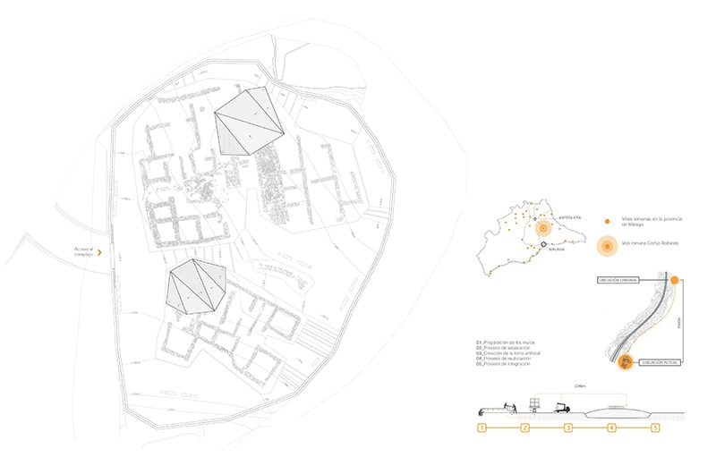
Worth saying up front: we did not move it. By the time we drew up the project, the artificial mound, its drainage and the re-erection of the remains had already been carried out by others. Before any of that, the site and its setting were recorded with a 3D laser scan, using the same sweep technology employed in underwater archaeology, applied here on dry land. That model is what allowed a new mound to be built with the topography of the original hill, and the remains to be set back on it, in large part stone by stone.
The paperwork explains why the move was an obligation rather than a design idea. The regional culture department (Delegación Provincial de Cultura) issued protection measures, reported favourably and authorised the extraction, transport, relocation and re-erection. The villa is listed as site no. 256 in Antequera’s local plan (PGOU). Spanish heritage consent, incidentally, runs on a separate track from municipal planning permission: the authorisation was granted expressly without prejudice to the town hall’s own remit.
We came in for the final phase, working alongside archaeologists, historians and a graphic design and communications team. Two premises, neither of them aesthetic: respect for the surviving remains, and public access. Everything else followed from those.
Outdoor museum design for a site you are not allowed to touch
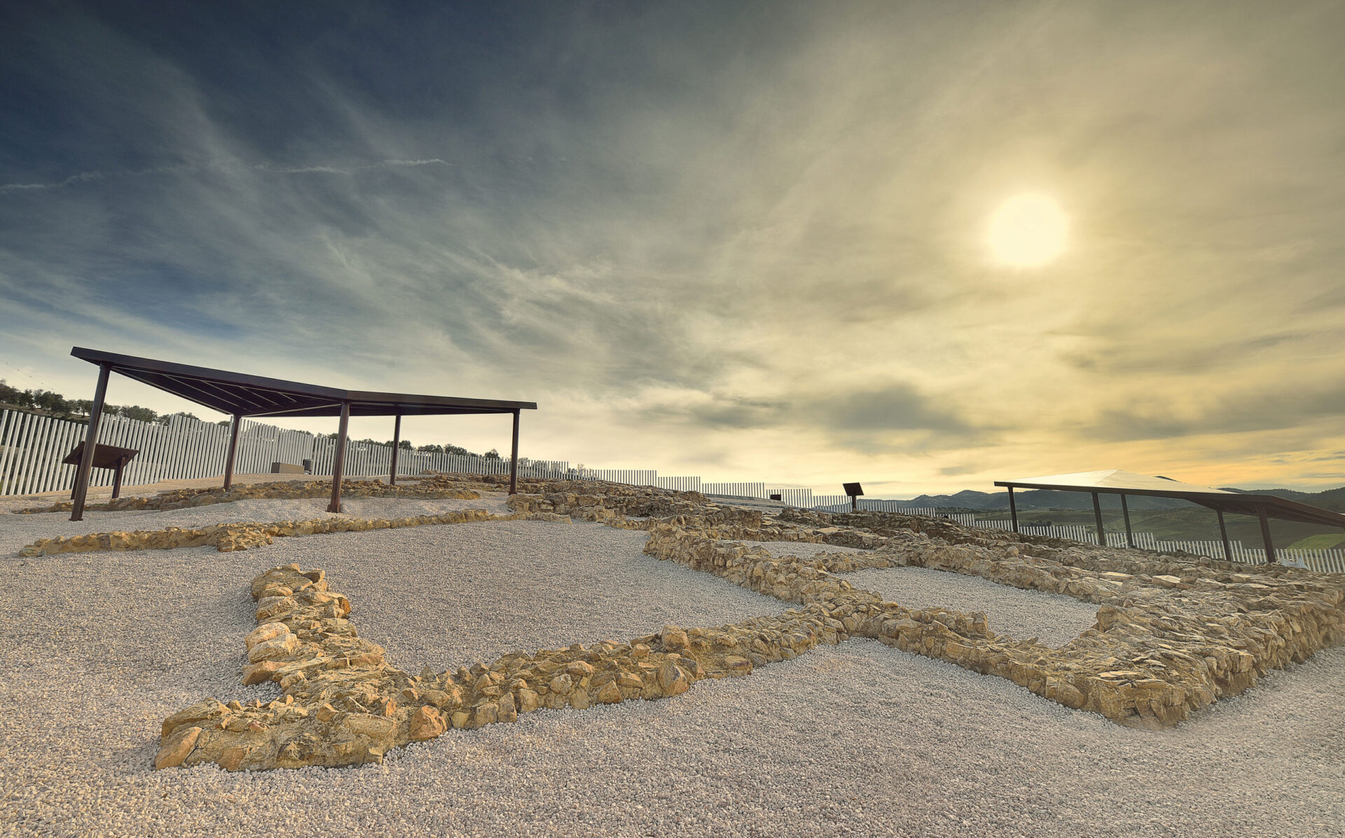
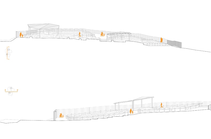
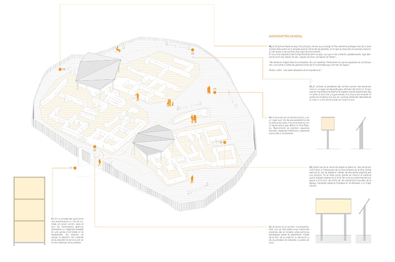
The relocation area covers 3,373.55 m². We worked on 2,141.00 m² of it: 1,109.15 m² of archaeological remains and 1,031.85 m² of paths. The route is a double perimeter loop, tangent to both archaeological areas, with crossing circulation, and it does not step on the remains at any point. The paths are 13/40 mm screened red crushed aggregate, laid 100 mm deep over ground compacted to 90 % Proctor. Ordinary road-building material: simple, permeable and liftable with a shovel.
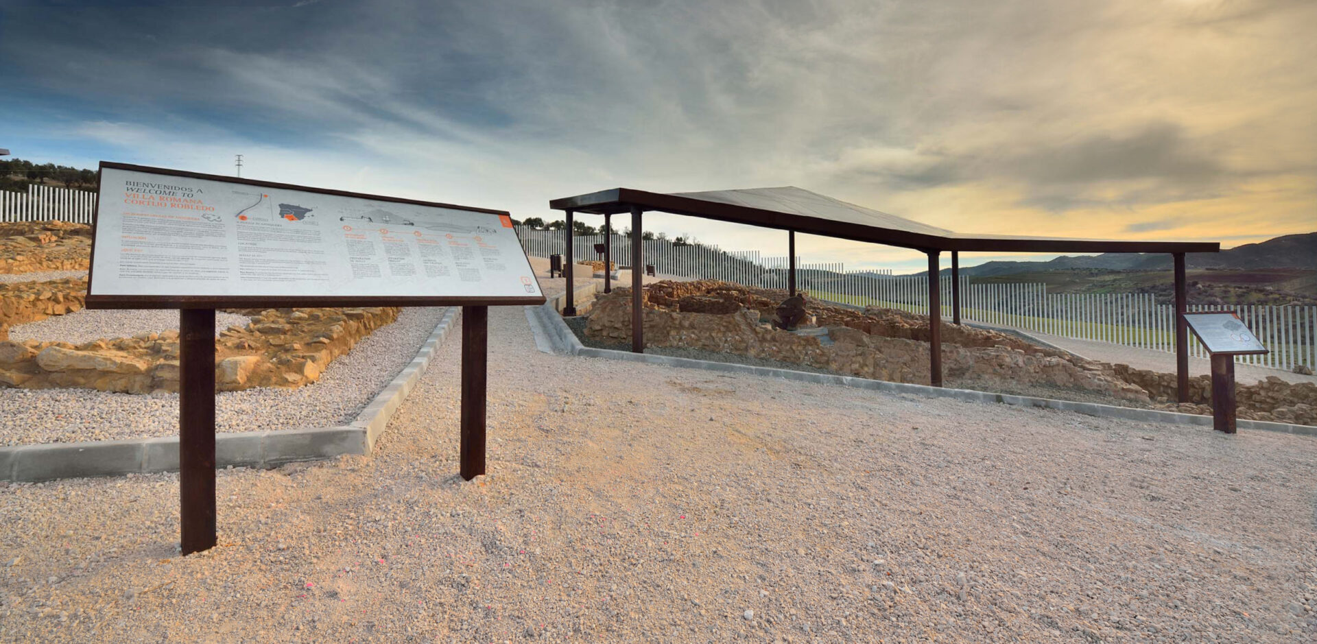
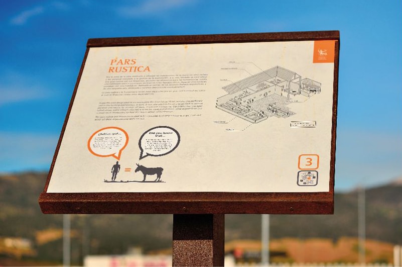
The villa had two halves: the pars rustica, where olive oil was produced, and the pars urbana, where people lived. We could have explained that with another sign. We explained it with the ground instead. The voids between the remains were filled with gravel in two colours, white and grey, so that the two zones read without anyone having to look at a panel. The panels, the lecterns in weathering steel and the marker at the entrance, stamped with the villa’s name, carry the written information.
Only two spots are covered, the two that will not survive being rained on: the oil storage vat in the production zone and the hypocaust in the residential one. That is 138.41 m² of canopy over 2,141 m² of works; everything else stays open to the sky. Both pergolas are polygonal on plan, with columns of varying height generating triangular enveloping planes. Abstract shapes, with nothing pastiche-Roman about them, set to read against the mountain ranges that surround the mound. S275 steel, 175.5 mm circular columns, IPE beams and isolated concrete pad footings in HA-25: the ground investigation returned an allowable bearing pressure of 0.1 N/mm², which is low, and the foundations were sized for it.
On site: a column landing on a Roman floor
Then the drawings met the ground. One of the columns of the hypocaust pergola clashed with an archaeological floor. Shifting it by a few centimetres was not an option, so the geometry of both canopies changed: the hypocaust canopy grew from 67 to 86 m², and the vat canopy shrank from 85 to 53 m² and went from six sides to five. That meant recalculating foundations and structure to the final geometry, with IPE-220 and IPE-180 main beams, IPE-120 edge beams and IPE-100 purlins.
Not everything was built as drawn, and it is fair to say so. At the client’s instruction, the weathering steel of the pergolas and benches was replaced by steel with a weathering-steel-effect paint finish; the treated timber fence by a stepped white event-type fence; the handrail by precast concrete kerbs; and the cut-and-fill sections with timber-sleeper steps were dropped. The practical completion certificate (certificado final de obra) was signed on 6 April 2013.
What it amounts to
We looked for precedents before starting and found no case in Spain of an entire Roman villa being moved. The nearest we could find were the Temple of Debod in Madrid and the Corominas site in Estepona, and neither poses quite the same problem.
The villa was made visitable in 2013, on a mound that did not exist, 2,340 metres from where it was built. What you actually see is two steel canopies, two colours of gravel and a red aggregate path. The architecture here earned its keep by how little of it there is. If you are dealing with heritage or an archaeological site in Málaga, contact our architecture studio in Málaga and we will take a look.
Gallery
Project data
- Typology: Heritage · outdoor museum design for a relocated archaeological site
- Site chronology: 5th century AD (Late Roman Empire / Late Antiquity)
- Use: Cultural (visitable archaeological site)
- Location: Cortijo Robledo, Antequera (Málaga, Spain)
- Design year: 2010-2011
- Construction year: 2013
- Status: Completed
- Built area: 138.41 m² of canopy (two steel pergolas)
- Plot area: 3,373.55 m² relocation area, with 2,141.00 m² within the scope of works
- Units: 2 steel protective canopies
- Programme: Lightweight protective canopies, accessible interpretive route, interpretive panels (pars urbana and pars rústica), site plan and documentary axonometric
- Strategy: Reversibility, low impact and minimal contact with the archaeological stratigraphy
- Client: Public administration (national road works), commissioned through a private archaeology firm
- Main contractor: Sacyr Vallehermoso, S.A.
- Architecture: Klic Arquitectos · Málaga
- Site direction (dirección de obra): Juan Goñi Uriarte and Ruth Buján Varela · Klic Arquitectos
- Works supervision (dirección de ejecución): Antonio Ramírez Escalona, technical architect
- Structural engineering: Jorge Barrios Corpa
- Graphic design and interpretation: Doctor Watson Comunicación
- Photography: Juan Diego Jiménez
- Architects’ Association stamp (visado): COA Málaga, 20 February 2012 (file 2012/000442/001)
- Klic services: Concept and technical design, and site direction
- Team: Juan Goñi Uriarte, Ruth Buján Varela, Alejandro Castillo, Myung Il Cano and Sun Il Cano
Other projects in Antequera
Discover our architectural keys to building or renovating a home in Antequera (Málaga) and our contemporary single-family homes Plot 200, Plot 54, Plot 12 and Plot 90, all in Antequera.